Building Information Modeling (BIM) has transformed how we design and manage facilities by creating rich digital representations of physical spaces. To integrating environmental sensors with BIM takes this a step further by feeding real-world data into the digital model. This combination enables live site monitoring – offering real-time insights into conditions like temperature, humidity, energy usage, air quality, and more within the context of the building model. By linking sensor data to a BIM, organizations can achieve smarter building operations, proactive maintenance, and improved comfort and safety for occupants.
In practice, this integration essentially creates a digital twin of the site: a dynamic BIM model continuously updated with live sensor inputs. The following sections outline five clear steps to achieve this integration in a practical, didactic manner. We will cover everything from initial planning and sensor deployment to data connectivity, visualization, and ongoing optimization, using real examples and proven practices along the way. This guide is written in a straightforward, technical tone for professionals (such as facility managers, engineers, or construction teams) seeking to implement sensor-BIM integration for more intelligent and responsive building management.
Table of Contents
5 Steps to Integrate Environmental Sensors with BIM for Live Site Monitoring
Step 1: Plan the Integration Strategy and Objectives
Begin by defining what you want to achieve with environmental sensor integration and how it will support your project or facility. This planning phase sets the foundation for a successful implementation:
-
Identify Key Parameters: Determine which environmental conditions or assets need monitoring. Common examples include temperature, relative humidity, carbon dioxide (CO₂) levels, light levels, sound (noise) levels, vibration, or energy consumption. Choose metrics that align with your goals – for instance, improving energy efficiency, ensuring occupant comfort, monitoring structural conditions during construction, or enhancing safety compliance.
-
Set Clear Objectives: Establish what outcomes you expect. For example, you might aim to reduce energy waste by tracking temperature and occupancy, or to improve indoor air quality by monitoring CO₂ and ventilation in real time. Defining clear goals (like a percentage reduction in energy use or maintaining certain comfort thresholds) will guide the rest of the integration.
-
Review the BIM Model: Ensure you have a detailed BIM model of the site or building that will receive sensor data. If working with an existing building, you might need to update the as-built BIM model or even create one if none exists. Verify that the BIM contains relevant spatial and system information (such as room zones, HVAC components, etc.) so sensor data can be meaningfully attached to model elements. It’s also wise to include placeholders or representations of sensors in the model (using the BIM’s family/components for devices or IFC’s IfcSensor entities) at the locations they will be installed.
-
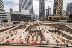
Plan Sensor Placement in BIM Context: Use the BIM during planning to decide optimal sensor locations. By visualizing the building’s spaces and systems in 3D, you can identify where sensors should be placed for effective coverage. For instance, plan to put temperature sensors at different heights in a large atrium, or locate air quality sensors in high-occupancy meeting rooms. If monitoring a construction site, decide on sensor points for areas prone to dust or vibration. The goal is to map out sensor positions in the digital model corresponding to real critical locations.
-
Consider Data and Integration Requirements: Early in the planning, outline how data will flow from sensors into the BIM environment. Decide on an integration approach – whether using a specific software platform, middleware, or custom solution. Investigate if your BIM software (such as Autodesk Revit, Navisworks, or a digital twin platform) supports live data links or APIs. Planning for data interoperability is crucial: for example, if using open standards, ensure your sensors or system can output data in formats that align with BIM standards like Industry Foundation Classes (IFC). Also think about any industry regulations or data security policies (especially if monitoring sensitive facilities) that need to be addressed.

Step 2: Select and Deploy the Environmental Sensors
With a solid plan in place, the next step is to choose the right sensors and get them installed on site:
-
Choose Appropriate Sensor Types: Select sensors that measure the environmental parameters defined in your objectives. For example, for indoor climate monitoring you might use temperature/humidity sensors and CO₂ sensors; for energy monitoring, smart meters or power sensors; for construction safety, dust particulate sensors or noise level meters. Ensure each sensor type has the accuracy and range needed for your use case (e.g. temperature sensors that cover expected min/max temperatures, or noise sensors that meet any regulatory standards for decibels).
- Wired vs. Wireless: Decide between wired and wireless sensors based on the project needs. Wired sensors often provide stable power and data transmission and are ideal for permanent installations (especially if you can run cables during construction). They are very reliable for critical applications but involve more complex installation (cabling, conduits) and are less flexible once installed. Wireless sensors, on the other hand, are easy to deploy without invasive installation – they communicate via protocols like Wi-Fi, Bluetooth, Zigbee, or LoRaWAN. These are excellent for retrofitting existing buildings or temporary setups on construction sites.
-
Environmental Durability: Ensure sensors are suited to their environment. Outdoor or construction site sensors should have proper enclosures (e.g. IP-rated for dust/water). Indoor sensors might need to blend with interiors (compact, aesthetic design) especially in occupied offices or public spaces. Also account for calibration and maintenance needs – for example, CO₂ sensors might need periodic calibration, and dust sensors may require cleaning. Choose robust devices with good vendor support for calibration or replacement parts.
-
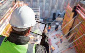
Installation and Commissioning: Following the plan from Step 1, install each sensor at its designated location. Use the BIM model as a reference – many teams print floorplans or 3D views from the BIM to guide installers on where exactly to mount devices (for instance, “2 meters above floor on the north wall of Room 101”). After physical installation, perform commissioning tests to ensure each sensor is functioning and reading values correctly. It’s wise to record the sensor’s unique ID, type, and location and cross-reference it with the BIM model: you might embed this information into the BIM’s data (for example, in a sensor object’s properties or an associated database).
-
Sensor Network Infrastructure: Alongside placing sensors, set up the network that will carry their data. If wired, this might mean connecting sensors to a building management system (BMS) or dedicated controllers via cables. If wireless, make sure there is adequate signal coverage – possibly deploying gateways or repeaters for protocols like LoRa or Zigbee. Ensure that each sensor’s data can reach the central data repository or platform (which we will integrate with BIM in the next steps). At this stage, you should have all necessary hardware in place and verified, ready to start streaming environmental data.
Suggested article to read: 5G in Buildings: 2024 Guide to Revolutionizing Smart Infrastructure
Step 3: Establish Data Connectivity between Sensors and BIM
With sensors deployed, focus on connecting their data output into your BIM ecosystem. This step involves building the IoT data pipeline and integration architecture:
-
IoT Data Pipeline Setup: Create a pathway for sensor data to travel from the physical devices to a database or application that can interface with BIM. Often, sensors send data to a gateway (local hub or controller), which then forwards the data to a server or cloud service. You might use an existing Building Management System (BMS) if it’s capable of exposing data, or an IoT platform (such as Azure IoT, AWS IoT, or open-source IoT servers) to collect and manage the streams. Key components of the pipeline include:
-
Gateways or Controllers: These aggregate data from multiple sensors, handle communication protocols, and sometimes pre-process the data. For example, a construction site might use a local gateway that collects readings from all dust and noise sensors and ensures they get to the cloud even on a limited internet connection.
-
Communication Network: Decide on how data is transmitted – it could be via Wi-Fi/Ethernet for on-site networks, cellular networks for remote sites, or LPWAN for long-range low-power needs. Ensure the network is reliable and secure (use encryption and secure credentials to protect data in transit).
-
Data Storage: Set up a database or time-series data store to hold incoming sensor readings. This could be cloud-based for scalability or on-premises for quicker local access. The storage should be structured and robust enough to handle continuous data (e.g., measurements every few seconds or minutes) from potentially dozens or hundreds of sensors.
-
- Middleware and APIs: To connect the sensor data with BIM, you will likely use middleware or an integration layer. This software acts as a translator between the raw sensor feeds and the BIM model. Many modern BIM platforms provide APIs or plugins for data integration. For instance, Autodesk’s Forge platform offers a data visualization toolkit that allows linking external sensor data to BIM model elements. If a ready-made solution isn’t available, you might develop a custom script or use a visual programming tool (like Dynamo for Revit) to pull data from your database and push it into the BIM. Ensure that the middleware handles schema mapping – aligning the format of sensor data to BIM’s data structure. This includes:
-
-
Matching sensor identifiers to the corresponding element or location in the BIM model (for example, linking the “Lobby Temperature Sensor #3” data stream to the BIM object representing the lobby space).
-
Converting units or formats if needed (e.g., if the BIM expects temperatures in Celsius but sensors provide Fahrenheit, apply conversion).
-
Time-stamping data and maintaining synchronization so that real-time updates correspond to actual sensor timestamps.
-
-
Using Standards for Interoperability: Leverage open standards where possible to reduce integration friction. The IFC standard, for instance, has definitions for sensors and can carry live data links. Some sensors or software support publishing data in standardized formats (like JSON or XML over REST APIs, or MQTT protocols) which can simplify integration with BIM tools. Ensuring interoperability means that down the line you can swap components (e.g., upgrade sensors or change software) without breaking the whole system.
-
Security and Reliability: As you establish connectivity, implement security measures. Use encryption (such as TLS for data in transit), secure authentication for devices and APIs, and network segmentation to protect the sensor network from unauthorized access. Also plan for reliability features: what if a sensor goes offline or the network drops? Your integration should handle missed data gracefully, perhaps by caching data on the gateway or having fallback sensors for critical parameters. By the end of Step 3, you should have live sensor data flowing into a system that the BIM can access, setting the stage for real-time visualization.
Step 4: Integrate and Visualize Real-Time Data in the BIM Model
Now comes the rewarding part – making the BIM model “come alive” with real-time sensor information. In this step, you will bind the incoming data to the BIM and set up intuitive visualizations for monitoring:
- Link Sensors to BIM Elements: Using the integration tools or middleware from the previous step, attach each sensor’s data feed to its corresponding object or location in the BIM model. For example, link a temperature sensor’s data to the room object in BIM that represents that physical room, or to an HVAC equipment piece if it’s measuring supply air temperature. This linkage may be achieved via unique IDs or naming. Some digital twin platforms allow you to virtually drop sensor widgets into the BIM model and bind them to data sources. Ensure each link is tested – you should see live values or status indicators in the model or associated interface.
-
Configure Data Visualization: Decide how the sensor data will be displayed to users in the BIM context. There are multiple effective visualization techniques:
-
Direct Values and Gauges: Display the live reading next to the object. For instance, show the current temperature value next to the space in a floor plan, or use a small gauge icon that fills up based on value (e.g., a thermometer icon filling as temperature rises).
-
Color-Coding (Heatmaps): One powerful method is to use color overlays on the BIM model based on sensor values. For example, rooms can be color-coded from blue (cool) to red (hot) based on temperature readings, updating as the data changes. This gives an at-a-glance thermal map of the building. Similarly, a heatmap can indicate areas of high CO₂ concentration or high noise levels on a site plan.
-
Dashboards and Charts: Augment the 3D model view with dashboards that plot sensor data over time. Many systems allow embedding charts (like a timeline of humidity for the past 24 hours) alongside the BIM view. This combination lets you correlate spatial information with trends. For example, you could click on a sensor in the model and see a pop-up graph of its last week’s data.
-
Alerts and Indicators: Set thresholds for important metrics and have the BIM visualization reflect when they are crossed. The model could, say, highlight a room in flashing red if temperature exceeds a comfort limit or if a vibration sensor on a structural element detects values beyond a safety threshold. Additionally, notifications can be configured (email or dashboard alerts) for such events.
-
-
User Interface and Accessibility: Present the integrated BIM in a way that your target users can easily access and interpret. For building operators or environmental engineers, this might be through a desktop dashboard application or a web-based BIM viewer that shows the real-time model. On construction sites, some may use mobile tablets to check sensor-linked BIM overlays while walking the site. Ensure the interface is not overly technical for end users – it should simplify complex data. Use clear legends for color-coding, tooltips for data values, and intuitive controls to navigate the model. The goal is that any stakeholder can quickly grasp the current conditions of the site by looking at the BIM model on screen.
- Example – Live Monitoring in Action: To illustrate, consider a large office building that has been instrumented and integrated with BIM. On the facility manager’s dashboard, the BIM floor plan is overlaid with live data: one glance shows that most areas are green, indicating normal conditions, but one meeting room is highlighted yellow due to rising CO₂ levels as it fills with people. The manager receives an alert and can proactively adjust ventilation or suggest a break to improve air quality.
Step 5: Analyze, Optimize, and Maintain the System
Integrating sensors with BIM is not a one-off project – it’s an ongoing process. In the final step, focus on using the data to drive improvements and ensure the integrated system continues to perform well:
-
Continuous Data Analysis: Regularly analyze the collected sensor data to identify patterns, inefficiencies, or anomalies. BIM integration helps contextualize this analysis. For instance, by reviewing a few weeks of data visualized in the model, you might notice that certain zones consistently run hotter in the afternoons – perhaps due to sun exposure. This insight can lead to actions like installing automated blinds or boosting afternoon cooling in those zones. Similarly, in a construction context, analysis might reveal that dust levels spike when working in a particular area, prompting additional dust suppression measures or schedule adjustments.
-
Optimize Building Performance and Operations: Use the insights gained to optimize building controls, processes, or layouts. A big advantage of having live data in BIM is seeing the cause and effect. For example, after integrating sensors, a university facility team discovered through their BIM dashboard that HVAC systems were active at night in empty buildings (much like the earlier lab example). By adjusting the building automation schedules and setpoints, they eliminated this wasteful operation. The result was significant energy savings without compromising occupant comfort – changes directly informed by the sensor data. Always loop back to your objectives set in Step 1 and measure progress. If your goal was energy efficiency, track energy consumption trends as you fine-tune systems.
-
Predictive Maintenance and Safety: Another benefit of sensor-BIM integration is the ability to predict issues before they escalate. Keep an eye on sensor readings that pertain to equipment health or structural integrity. For instance, vibrations on a motor or unusual temperature rise in electrical panels could signal an upcoming fault – the BIM model can highlight the equipment in question so maintenance staff know exactly where to intervene. Scheduling maintenance based on actual condition data (instead of fixed intervals) can reduce downtime and cost. In safety terms, continuous monitoring might alert you to hazardous conditions (like high carbon monoxide in a boiler room or excessive noise in a certain area) so you can respond immediately.

-
System Maintenance and Updates: Maintaining the integration itself is also important. Develop a routine to:
-
Calibrate sensors periodically and replace any that fail, updating the BIM model if a sensor is moved or changed.
-
Keep the software and middleware updated to the latest versions for security and compatibility.
-
Refine the BIM model as the building or site changes. If walls are moved or new equipment is installed in reality, update the BIM so that your sensor context remains accurate. An outdated model could mislead interpretations of sensor data.
-
Train team members to use the system and interpret the data. Document the integration setup so that new personnel can understand how sensors map to the BIM and how to operate the monitoring interface.
-
-
Scale and Innovate: Finally, consider scaling up your integrated monitoring if it’s proving valuable. You might expand to more buildings or add additional types of sensors (for example, adding occupancy sensors to correlate people presence with environmental conditions, or adding water leak sensors for facility management). Stay informed about new technologies – perhaps advanced IoT sensors or AI analytics – that could further enhance your system. The integration of environmental sensors with BIM is a cornerstone of smarter, more sustainable facilities and sites. By continuously optimizing and maintaining this system, you ensure that the benefits (energy savings, improved comfort, safer operations, etc.) persist and grow over the building’s lifecycle.
FAQs
How do you integrate environmental sensor data into a BIM model for real-time monitoring?
Integrating environmental sensor data into a BIM model involves using an IoT data pipeline and a digital twin or BIM platform that supports live data. First, sensors collect real-time environmental metrics (like temperature, humidity, or energy use) and send this data to a central database or cloud. Then, through middleware or built-in BIM software APIs, the sensor data is linked to corresponding elements or zones in the BIM model. This setup allows the BIM model to display live readings (often as visual indicators or dashboards) in sync with what is happening on site. In practice, you might use specialized software or scripts to bind each sensor’s feed to the BIM, enabling interactive, up-to-date monitoring within the model.
Which types of environmental sensors are commonly integrated with BIM for live monitoring?
Common environmental sensors used in BIM integrations include: temperature and humidity sensors (for climate monitoring in different rooms or zones), CO₂ and air quality sensors (to track indoor air quality and ventilation effectiveness), light sensors (measuring illumination levels, useful for lighting control and comfort), occupancy or motion sensors (to detect presence and help correlate environmental conditions with occupancy).
Energy meters (measuring electricity, gas, or water usage by different systems), noise level sensors (especially on construction sites or in sensitive building areas for acoustic monitoring), and vibration or structural sensors (to monitor building movement or equipment vibrations for maintenance). The choice of sensors depends on the use case – for example, smart building management often focuses on climate and energy sensors, while a construction site might employ dust, noise, and vibration sensors for safety and compliance.
What software tools are needed to connect BIM with live sensor data?
To connect BIM with live sensor data, you will typically use a combination of IoT platform software and BIM or digital twin software that supports integration. On the IoT side, you need a data collection platform (this could be a cloud service like Azure IoT or AWS IoT, or a local server with a database) that aggregates all sensor inputs.
On the BIM side, you need a tool or plugin that can pull data from that IoT source and inject it into the model. Many modern BIM solutions have this capability: for example, Autodesk Tandem or Forge offers digital twin services to map sensor data to BIM, and other BIM viewers or FM (Facility Management) systems have APIs for data integration.
In some cases, middleware is used – a custom application or a third-party software that acts as a bridge between the sensor database and the BIM model, handling data translation and synchronization. Additionally, visual programming tools like Dynamo (for Revit) can be employed to script data import into BIM. The key is that the software stack must allow real-time data exchange; so the “tools” range from IoT data ingestion software, networking, and databases, to the BIM/digital twin platform with integration support.
Is it true that integrating environmental sensors with BIM can improve energy efficiency and building performance?
Yes, integrating environmental sensors with BIM can significantly improve energy efficiency and overall building performance. When sensor data (such as temperature, occupancy, or equipment status) is fed into a BIM-based management system, it provides a clear picture of how the building operates in real time. This transparency helps identify inefficiencies and optimization opportunities. For example, live data might reveal that certain areas are being over-cooled or heated when unoccupied, or that lights remain on in empty rooms – issues that can be corrected once detected.
In real-world cases, organizations have used sensor-integrated BIM dashboards to fine-tune HVAC schedules and settings, resulting in substantial energy savings. It also improves performance by ensuring occupant comfort and equipment reliability: facility managers can proactively adjust conditions based on actual usage patterns and address problems (like a faulty thermostat or an overworked chiller) before they escalate. In summary, the integration enables data-driven decisions that balance energy use with occupant needs, leading to a more efficient, comfortable, and high-performing building.
Conclusion
Integrating environmental sensors with BIM for live site monitoring is a powerful way to bridge the gap between a building’s digital model and its real-world performance. By following these five steps – from careful planning and sensor deployment to establishing robust data connectivity, real-time visualization, and continuous improvement – organizations can create dynamic digital twins that provide immediate insight and long-term trends.
This synergy between BIM and live sensor data empowers facility managers, engineers, and stakeholders to make informed decisions that improve efficiency, comfort, and safety. The process is both technical and organizational: it requires the right hardware and software setup, but also a clear vision of the goals and the commitment to act on the insights gained. Ultimately, the reward is a smarter building or construction site where data-driven management becomes the norm, leading to optimized operations and a better environment for everyone involved.
Resources:
European Agency for Safety and Health at Work. (2022). Improving compliance with occupational safety and health regulations.
Harvard Business Review. (2016). Smart Cities Start with Smart Buildings.
Autodesk. (2022). BIM and IoT Integration with Digital Twins.
Novedge. (2024). Revolutionizing Architecture: Integrating BIM with IoT for Smart Buildings and Predictive Maintenance.
For all the pictures: Freepik
Suggested article for reading:
7 Practical Steps to Implement Well-being Management in Construction Projects (Checklist + Timeline)
9 Worker Wellbeing Metrics Every Construction Firm Should Track in 2026
11 Psychosocial Risks on Construction Sites (and How ISO 45003 Helps You Manage Them)
6 Ways Construction Well-being Programs Reduce Incidents and Lower Insurance Costs
3 Steps to Build a Construction Well-being Strategy Aligned with ISO 45003