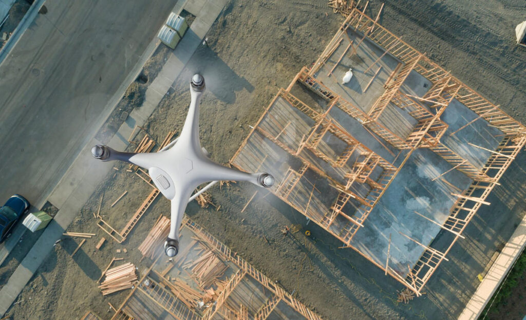
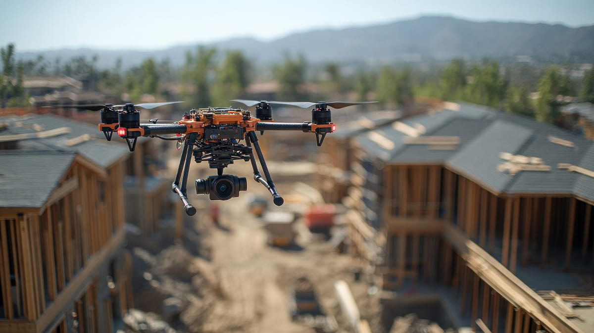
Construction sites are dynamic environments that can significantly impact their surroundings. Environmental Sensors on Construction Site drones are emerging as powerful tools to monitor and manage these impacts. By equipping drones with specialized sensors, construction teams can collect real-time data on dust, emissions, noise, and more, allowing them to make informed decisions for a safer and more sustainable project. In this article, we explore 11 practical use cases where drones combined with environmental sensors are transforming construction site monitoring – from dust mapping and emissions tracking to surveying and beyond. The tone is technical yet easy to understand, providing real examples and clear explanations as if for an internal training manual.
Table of Contents
11 Use Cases for Drones + Environmental Sensors on Construction Sites
1. Dust Mapping and Air Quality Control
Dust generation is a constant challenge on construction sites, especially during activities like excavation, demolition, or concrete cutting. Drones outfitted with particulate matter sensors (for PM2.5, PM10, etc.) can map dust distribution across and around a site. By flying through various locations and elevations, the drone gathers air quality data that highlights dust concentration “hotspots.” Project managers get a visual dust map of the site, showing where dust levels are highest and how far dust travels beyond the site boundaries under different wind conditions.
This insight is invaluable for implementing targeted dust control measures – for instance, placing misting cannons or barriers at specific locations, or altering work schedules on windy days. In one real example, a contractor used drone dust monitoring data to adjust their suppression tactics, resulting in noticeably clearer air at nearby residences. By proactively mapping dust, construction teams protect worker health and reduce nuisance dust in the surrounding community. Over time, the data can also feed into compliance reports to ensure the site stays within regulatory dust limits. In summary, dust mapping drones act as airborne air-quality inspectors, helping maintain safe breathable air on and off the construction site.
2. Emissions Monitoring for Pollution Reduction
Heavy machinery, generators, and vehicles on a construction site produce exhaust emissions such as carbon dioxide (CO₂), nitrogen oxides (NOx), and particulate pollution. Drones with gas sensors can monitor these emissions from above, offering a new way to track a site’s carbon footprint and pollutant output. By hovering near work areas or equipment exhausts, sensor-equipped drones detect levels of greenhouse gases and pollutants in real time.
For example, a drone can fly downwind of an active diesel excavator to measure its output of NOx or soot. The collected data helps identify which operations or machines contribute the most to air pollution on site. With this information, project managers might decide to retrofit equipment with better filters, enforce anti-idling policies, or schedule high-emission tasks at times that minimize impact.
Emissions-monitoring drones are especially useful for ensuring environmental compliance in urban projects where air quality standards are strict. They can also track improvements over time – for instance, confirming that switching to newer, low-emission machinery has indeed reduced on-site emissions. Beyond regulatory needs, this use case contributes to sustainability goals by helping construction firms measure progress toward lower carbon and cleaner air on their projects. By using drones as “emission scouts,” companies gain a practical tool for both pollution reduction and transparent reporting of environmental performance.
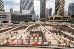
3. Surveying and Topographic Mapping
Accurate surveying is fundamental to construction planning and environmentally responsible site management. Drones carrying high-resolution cameras or LiDAR sensors excel at topographic mapping and land surveys. With a drone, surveyors can quickly capture detailed aerial images and terrain data over the entire construction site and its surroundings. This process generates orthomosaic maps, 3D elevation models, and volumetric measurements of earthworks.
The environmental benefit is twofold: first, drone surveys minimize disturbance to the land compared to sending crews to trek across sensitive areas; second, they provide precise data to plan earthwork and drainage in ways that respect natural contours. For example, a drone survey might reveal where water naturally flows or collects on the site after rain. Engineers can then design proper grading, retention ponds, or silt fences to manage runoff, preventing erosion and protecting nearby streams.
Additionally, mapping drones help identify ecologically sensitive zones, such as wetlands or wildlife habitats, so that construction activities can avoid or mitigate impact on those areas. By integrating drone survey data into site plans, teams optimize material placement, avoid unnecessary land clearing, and reduce rework. The result is a more efficient construction process with fewer environmental side effects. In practice, companies have found that using drones for surveying not only cuts weeks off their schedule but also improves environmental outcomes by enabling smarter, data-driven decisions about site layout and earth moving.
Suggested article to read: What is Eco Friendly Construction & Why is it important? 2024 Guide
4. Noise Level Monitoring and Management
Construction sites can be very noisy, affecting workers and nearby communities. Noise monitoring drones provide a flexible way to measure sound levels around a site. Equipped with microphones and sound level meters, a drone can fly to various points (for instance, near the site perimeter or above different equipment) and record decibel levels. This is particularly useful in urban or residential areas where noise ordinances apply.
The drone can create a noise map by sampling sound at multiple altitudes and locations, pinpointing sources of excessive noise such as a loud generator or heavy jackhammering activity. With these insights, site managers can take practical steps to manage noise: scheduling the noisiest work for mid-day instead of early morning or night, installing temporary sound barriers where needed, or ensuring equipment has proper mufflers and maintenance.
Drones can also monitor noise at sensitive receptors – for example, near a school or hospital adjacent to the construction project – without the need to set up stationary sensors in those areas permanently. This on-demand monitoring helps quickly address complaints by verifying the noise levels and documenting compliance with limits. It also contributes to worker health by identifying zones on-site that require hearing protection. Overall, using drones to gauge sound levels allows construction teams to be proactive and transparent about noise control. They can demonstrate with data that they are taking measures to keep construction noise within acceptable bounds, thus maintaining good community relations and adhering to environmental noise regulations.
5. Water Runoff and Water Quality Surveillance
Managing water on a construction site is critical for both project progress and environmental protection. Drones with environmental sensors and cameras assist in monitoring water runoff and quality in several ways. After heavy rain, a drone can overfly the site to identify how water is flowing or pooling. High-resolution imagery reveals any breaches in erosion control measures – for example, if silt fences are overflowing or if mud is washing into public roads or waterways. Some drones can be equipped with thermal or multispectral cameras that highlight moisture differences, helping detect hidden water accumulation or leaks.
Additionally, drones can carry lightweight water quality sensors or drop devices (such as pH, turbidity, or conductivity sensors) to test water in retention ponds or nearby streams. By sampling water at various points, the drone provides data on sediment levels or contaminants leaving the site. A practical use case is during foundation dewatering or pumping: a drone can track where that water is going and whether it’s causing erosion downstream. With this information, contractors can quickly reinforce barriers, adjust drainage routes, or treat the water before release.
In one scenario, a drone survey identified sediment-laden runoff escaping a site during a storm; the crew was alerted and promptly installed additional straw wattles and check dams to contain the silty water. Such proactive monitoring prevents environmental violations and harm to local aquatic ecosystems. Overall, drones give construction managers an “eye in the sky” to ensure their stormwater management plans are effective, keeping waterways clean and avoiding fines or project delays related to water pollution issues.
6. Soil Erosion and Land Disturbance Tracking
Construction often involves clearing vegetation and moving large amounts of soil, which raises the risk of soil erosion if not carefully managed. Drones come in handy to continuously track changes in soil conditions and land disturbance throughout the project. By periodically capturing aerial images, drones enable a comparative view of the site over time – for instance, showing how slopes and stockpiles evolve week by week.
Specialized drone software can detect differences between surveys and flag areas where significant ground loss or gullying is occurring. Environmental sensors like high-resolution cameras or even LiDAR can pick up subtle topographical changes that indicate erosion. If a drone’s survey shows that a recently graded hill is starting to wash away after rain, the team can respond by strengthening erosion control measures (like adding matting or re-grading the slope). Drones also help ensure that the extent of land disturbance stays within permitted boundaries.
The site’s footprint can be outlined on the drone’s map to check that crews haven’t accidentally cleared beyond the approved area (which could impact adjacent habitats or properties). Moreover, for long linear projects such as road construction, drones can patrol the corridor and spot where soil might be sliding or sediment is accumulating in unwanted places. A real-world application of this was seen on a highway project where routine drone flights identified an area of embankment starting to erode; engineers were able to stabilize it with rock and vegetation before it became a bigger problem.
7. Gas Leak Detection and Hazardous Fumes Monitoring
Some construction projects involve working near utility lines, old landfills, or using chemicals that could release hazardous gases. Safety and environmental concerns demand vigilant monitoring for any gas leaks or dangerous fumes. Drones equipped with gas detection sensors (such as methane detectors, VOC sniffers, or carbon monoxide sensors) can literally sniff the air in hard-to-reach places. For example, during the excavation of an old industrial site, there might be buried pipelines or pockets of methane; a drone can fly low over trenches with a methane sensor to detect any leak before workers are harmed.
Similarly, when doing bridge or tunnel work, drones can measure carbon monoxide levels from machinery in confined areas to ensure ventilation is adequate. These drones use technologies like infrared cameras for optical gas imaging or laser-based sensors that can pinpoint gas concentrations from a distance. The advantage of using a drone is that it can approach a potentially hazardous zone without risking a human inspector. If a toxic gas plume is suspected (say from a chemical spill or a ruptured gas line), the drone can map the concentration and spread of that plume quickly.
This data is crucial for emergency response – it tells crews where to evacuate people, wear respirators, or set up ventilators. Construction companies have also used gas-sensing drones as part of their routine safety inspections around fuel storage tanks or sewer lines being worked on. Catching a gas leak early prevents not only environmental contamination but also catastrophic accidents like fires or explosions. In summary, drones carrying gas sensors serve as high-tech safety sentinels, continuously sniffing out invisible dangers. They enhance both environmental protection and worker safety by providing early detection of hazardous gases and allowing rapid intervention.
8. Thermal Imaging for Environmental and Safety Checks
Thermal cameras mounted on drones offer a unique perspective by detecting heat signatures rather than visible light. This capability has several use cases on construction sites related to environment and safety. Thermal imaging drones can survey structures and equipment to find abnormal heat spots – which might indicate problems like overheating machinery, electrical faults, or even smoldering fires. From an environmental standpoint, thermal maps of a site can reveal energy inefficiencies in built structures (e.g., heat loss through a building envelope) or help ensure temporary heating systems are properly used and not wasting fuel.
uring concrete curing in cold weather, for example, a thermal drone flyover can confirm that heating blankets are uniformly warming the slabs, ensuring quality and avoiding wasted energy. Thermal drones are also excellent for fire risk monitoring: on a large site with flammable materials, the drone can scan for any unusual hot areas (like a hotspot in a sawdust pile or chemical storage) so that action can be taken to prevent an incident. Another environmental application is checking soil or material temperatures – useful in asphalt paving to ensure proper compaction temperatures or detecting leaks in heated pipelines.
Additionally, thermal imagery can assist in ecological surveys; for instance, spotting warm-bodied animals (like nesting birds or small mammals) in areas about to be cleared, so they can be relocated or protected. In one practical instance, a drone with an infrared camera identified a hidden hot spot in a waste dumpster that could have ignited – the crew was alerted to extinguish it, averting a potential fire and pollution event. By providing an invisible layer of insight, thermal drones allow construction teams to enhance safety, optimize energy use, and catch environmental anomalies that are not apparent to the naked eye.
9. Wildlife and Habitat Monitoring
Large construction projects, especially those in undeveloped or greenfield areas, must be mindful of their impact on local wildlife and habitats. Drones offer a non-intrusive way to monitor these environmental aspects throughout the project lifecycle. Equipped with zoom cameras or even multispectral sensors, drones can periodically survey the surrounding environment for any changes in vegetation health or wildlife activity. For example, if a construction site is near a bird nesting area or a protected woodland, drones can be flown along the perimeter to check if construction noise, dust, or lighting is affecting animal behavior.
They might observe whether birds are avoiding certain areas or if any new nesting has occurred close to the work zone. Multispectral imagery can highlight stressed vegetation (perhaps due to dust deposition or changes in groundwater from site dewatering). One use case involved a drone survey that detected declining vegetation vigor downwind of a construction site – this alerted the team to bolster their dust control measures, which helped the plants recover. Drones can also help fulfill environmental impact assessment commitments by documenting that buffer zones around habitats remain intact, and that no unauthorized encroachment has happened.
In some cases, during pre-construction, drones assist in identifying the presence of endangered species (like spotting wildlife paths or dens) so that the project can adjust its plans to avoid those areas. What makes drones ideal for this is their ability to cover rough or inaccessible terrain quickly without disturbing animals as a ground crew might. By acting as the “eyes” on local ecology, drones enable construction managers to take a proactive, responsible approach. This not only helps avoid legal issues by complying with wildlife protection regulations, but also ensures the project upholds good stewardship of the environment by minimizing harm to the local ecosystem.
10. Environmental Compliance Documentation and Reporting
Modern construction projects operate under numerous environmental regulations – air quality standards, noise limits, erosion control rules, waste disposal requirements, and more. Keeping track of all these and proving compliance can be challenging. Drones with environmental sensors simplify this by providing hard data and visual evidence for compliance documentation. Throughout the project, a series of drone flights can record the state of various environmental measures: for instance, weekly aerial photos showing that sediment barriers are in place and intact, or sensor logs showing dust levels were kept below threshold on each day of demolition.
Instead of relying solely on manual logs or occasional third-party inspections, the construction firm can compile drone-collected data into comprehensive reports. If an inspector or community member raises a concern (say about excessive dust or muddy runoff), the project team can produce time-stamped drone images and air quality readings to address the issue transparently. In practice, some contractors set up a routine where a drone autonomously patrols the site perimeter each day, measuring key parameters like particulate matter and noise at fixed checkpoints. The data is automatically uploaded to a cloud system, creating a digital paper trail of compliance. This kind of record-keeping is extremely valuable during regulatory reviews or post-project environmental audits.
It demonstrates due diligence and can protect the company in case of disputes by showing factual evidence of their environmental performance. Furthermore, real-time alerts from drone sensors (for example, an alert if dust spikes above a set level) allow immediate corrective action, ensuring that breaches of compliance are avoided in the first place. By using drones as part of an Environmental Management Plan, construction teams make compliance a continuous, proactive process rather than a reactive paperwork exercise. The result is not only fewer violations and fines, but also a smoother relationship with regulators and the public.
11. Emergency Response to Environmental Incidents
Despite best efforts, accidents and unexpected events can happen on construction sites – a fuel spill, a small fire, or a containment failure releasing contaminants. In these urgent situations, drones with the right sensors become an invaluable part of the emergency response toolkit. They can be deployed within minutes to assess the situation from above, guiding the response team with live information. For example, imagine a construction site accident where a diesel storage tank is punctured, spilling fuel on the ground. A drone can quickly fly over the spill area with a high-resolution camera to map the extent of contamination, while possibly using a thermal sensor to ensure no unseen hot spots could ignite.
If the spill is near a water body, the drone can follow the path of the runoff to see if fuel is entering a creek, helping responders place booms or barriers effectively. In case of a fire or chemical release, a drone outfitted with a gas detector can sample the air to identify hazardous fumes and determine the direction they are drifting. This information is critical for deciding if neighboring areas need evacuation or if workers should deploy specific protective equipment. Using drones in these scenarios keeps personnel at a safe distance while still obtaining the detailed intelligence needed to act decisively.
One real-world example: when a construction site in an industrial park caught fire, an aerial drone provided thermal imagery to firefighters, showing them where the hottest spots were and where firefighting efforts should be concentrated to prevent toxic smoke from spreading. After the emergency, the same drone data can be used to document the incident’s impact on the environment and guide cleanup operations (for instance, identifying where soil remediation is required). In summary, drones serve as first responders for environmental incidents on construction sites. They enhance the speed, safety, and effectiveness of the response, helping to contain any damage and protect both people and the environment from greater harm.
FAQs
How do drones help monitor dust and air quality on construction sites?
Answer: Drones can be fitted with air quality sensors to measure dust (particulate matter) and other pollutants around a construction site. By flying on planned paths, they collect real-time data on dust concentration at various locations and heights. This helps identify where dust levels are high so that crews can focus dust suppression (like water spraying) in those areas. Essentially, drones provide a quick way to map and monitor air quality across the whole site, something that would be difficult with stationary monitors alone.
What types of environmental sensors can drones carry for construction monitoring?
Answer: Drones are versatile and can carry many sensor types. Common environmental sensors used on construction sites include particulate matter sensors for dust, gas sensors (for detecting gases like CO₂, methane, or volatile organic compounds), thermal infrared cameras for heat mapping, microphones for noise level monitoring, and multispectral cameras for assessing vegetation health or water quality indicators. These payloads allow a drone to gather data on air, water, soil, noise, and more during a single flight.
Which environmental factors can drones monitor during construction projects?
Answer: Drones can monitor a wide range of environmental factors on a construction project. Key examples are: air quality (dust, emissions, and smoke), noise levels, water runoff patterns and water quality (like turbidity or contamination in ponds and streams), ground conditions (soil erosion or land changes), and even the status of nearby vegetation or wildlife habitats. In practice, this means a drone can help ensure the project isn’t polluting the air or water, is controlling noise, and isn’t causing undue harm to the surrounding land and ecosystem.
Is it true that drone monitoring can help construction sites meet environmental regulations?
Answer: Yes, drone-based monitoring significantly helps construction sites comply with environmental regulations. Drones gather accurate data that can be used to prove compliance with limits on dust emissions, noise, water pollution, etc. For example, if regulations require dust levels to stay below a threshold at the site boundary, a drone can regularly measure and confirm this. If a potential violation is detected (like high noise at night), the project team can fix it quickly. By catching problems early and keeping detailed records (photos, sensor readings), drones make it easier for construction companies to follow the rules and provide evidence of their compliance to regulators.
Conclusion
Drones equipped with environmental sensors are revolutionizing how construction sites are monitored and managed. From controlling dust and tracking emissions to surveying terrain and protecting wildlife, these high-tech tools provide construction professionals with unprecedented insight into their project’s environmental footprint. Each use case we explored – whether it’s mapping air quality hotspots or ensuring water runoff is clean – demonstrates the practical, data-driven approach drones enable on modern job sites. By integrating drones into daily operations, companies can detect issues early, respond proactively, and document compliance with ease.
The result is not only a reduction in negative environmental impacts but also improvements in efficiency, safety, and community relations. In essence, drones bridge the gap between heavy construction work and the need for diligent environmental stewardship. As the construction industry continues to adopt these technologies, we can expect worksites to become smarter, cleaner, and more sustainable. Embracing drones with environmental sensors on construction sites is no longer just an innovative idea – it’s fast becoming a best practice for responsible and efficient project delivery.
Resources:
-
Associated Builders and Contractors Hawaii. (2025). How Drones in Construction Boost Efficiency and Safety.
-
Dukowitz, Z. (2025). Drones in Construction: An In-Depth Guide. UAV Coach.
-
Stoner, J. (2023). AI-Enabled Drones: The New Era of Construction Efficiency. FlyEye Blog.
-
Envirotech Engineering. (2023). Revolutionizing Construction with Drones.
-
MFE Inspection Solutions. (2025). Gas Detection Drones: An In-Depth Guide.
For all the pictures: Freepik
Suggested article for reading:
7 Practical Steps to Implement Well-being Management in Construction Projects (Checklist + Timeline)
9 Worker Wellbeing Metrics Every Construction Firm Should Track in 2026
11 Psychosocial Risks on Construction Sites (and How ISO 45003 Helps You Manage Them)
6 Ways Construction Well-being Programs Reduce Incidents and Lower Insurance Costs
3 Steps to Build a Construction Well-being Strategy Aligned with ISO 45003