Updated by Nazanin Ghodsian, 10/15/2024
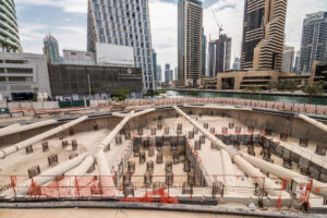
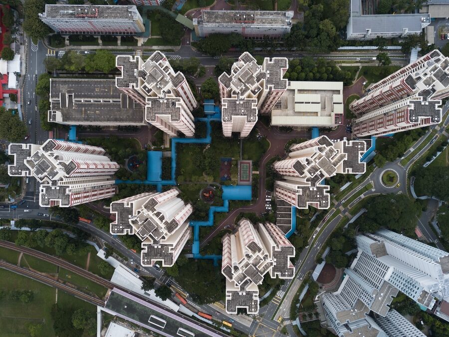
The complex networks of streets and buildings that make up our cities make it difficult to plan usable places before construction ever starts. Urban landscapes can be very complicated, especially in light of the World Bank’s claim that 56% of the world’s population currently lives in cities, a percentage that is predicted to rise to 70% by 2050. We must use every resource at our disposal to build sustainable, habitable cities for future generations since unbridled urbanization threatens the planet’s already delicate ecosystems. City Information Modeling (CIM), which provides creative methods to manage and depict the urban landscape, is one of the most promising tools at our disposal.
Similar to the well-known SimCity video game, which Maxis produced in 1989 and let users create their own imaginary cities, City Information Modeling brings this idea to actual urban planning. With the ability to establish development zones, plan infrastructure, and turn barren land into bustling metropolises, SimCity enthralled gamers. In a similar vein, CIM provides a sophisticated platform for planners, architects, and stakeholders to work together on initiatives that affect the entire city. We can better negotiate the complexity of urban planning by using City Information Modeling, ensuring that our cities continue to be sustainable and responsive to the demands of their residents while still operating effectively.

Table of Contents
What is City Information Modeling (CIM)?
Let’s quickly review BIM, CIM’s closest relative, before we define city information modeling (CIM). The digital technique of producing highly interactive three-dimensional representations of specific structures is known as Building Information Modeling (BIM). BIM, a cutting-edge technology that has created entirely new job opportunities in the construction sector, has surpassed CAD in the last ten years as the preferred approach for project design. BIM has become widely used by nearly all US-based architectural firms.
The next logical step forward is City Information Modeling (CIM). Consider these two forms of technology as video games. SimTower is BIM, and SimCity, its follow-up, is CIM. The first focuses on creating and maintaining single virtual buildings; in the second, the concepts are extended to address large cityscapes.
City Information Modeling (CIM), called Civil Information Modeling or Construction Information Modeling, is a 3D modeling technique that creates highly interactive models of large-scale urban landscapes by combining data from multiple sources. The model encompasses all infrastructure, both underneath and above ground. While BIM has gained widespread acceptance, CIM has the potential to completely transform the way cities are planned, constructed, and managed soon.
Similar to BIM, the 3D metropolises constructed in city information modeling’s virtual sandbox provide more than just eye-catching visuals. When city information modeling performs at its best, it functions as a virtual library containing all the knowledge that can be found about the city it represents.
Would you like to know how many people live on a specific city block? or What is this building cluster’s total carbon footprint? What effects will shifting weather patterns have on various parts of the city? CIM has the answers to all of these queries and more. In addition to simulating current appearances, CIM offers an integrated virtual platform that allows for the analysis and alteration of any part of a city.
How Does City Information Modeling (CIM) Work?
It should come as no surprise that modeling an entire city accurately is a little more difficult than modeling a single structure. To accomplish this, city information modeling has to smoothly combine many datasets that have been gathered from various sources. For the sake of this discussion, we will be focusing on the GIS, BIM, LiDAR, and IoT components of the jigsaw. The quantity and kind of those sources may vary based on the particular project.
The first thing you should do when using CIM to create a virtual model of an urban setting is look at the Geographic Information System or GIS. This digital mapping tool stores institutional, historical, and spatial data about properties, structures, and land. When it comes to pinpointing the exact locations of structures concerning one another, GIS can be useful in the city information modeling process.
The next step is to think about the function of BIM. The most effective method to get the most precise image of every single structure while creating a brand-new city is to construct it using Building Information Modeling (BIM) initially. Let’s take an example where you operate in a part of an established metropolis where a large number of recently constructed buildings were originally designed and constructed using Building Information Modeling (BIM).

Perhaps you want to expand or enhance an existing metropolitan area rather than building a brand-new one. The problem is that most towns and cities have a mix of older and newer buildings.
While older structures designed before the days of pen and paper designs are probably kept in GIS, they lack BIM files and other comprehensive digital documentation of their operational history. You want your virtual city to be complete, but one problem is that older structures don’t have BIM files.
Fortunately, it’s not insurmountable. Using quick scanning technologies to record the inside and external geometries of the structures, such as LiDAR (Light Detection and Ranging) or photogrammetry, is one way to solve the problem. The older buildings can then be simply linked into the CIM model by creating 3D models of them from this point on.
All of the input data may be combined to create a 3D virtual environment called city information modeling, which can be used to automatically track and evaluate real-time activities in actual cities. With this feature, CIM becomes more than just a static representation; it becomes a dynamic simulation that adapts to human behavior and changes over time.
The Benefits of City Information Modeling (CIM)
Like BIM did before it, CIM creates an entirely new set of opportunities for those who design cities as well as those who live there. Here is a quick summary of some of the advantages that city information modeling offers.
Centralizing Information and Placing it in Context
Using BIM (Building Information Modelling), designers, builders, and architects can oversee every stage of the construction of a building or infrastructure project, from planning and design to possible demolition and material reuse, all from one location.
Products, systems, spaces, and sequences are all displayed concerning one another and the project as a whole. Because city information modeling spans a larger region, infrastructure may be accurately modeled in geographic settings at the city level, regardless of whether it is now under development or is just in the design phase.
Whether researching property-specific details about a material being used or modeling a change to the original plan, anyone working on a project utilizing BIM or CIM may access information about any part of the infrastructure being created and utilize it for any purpose.
Thus, BIM may be thought of as a platform that not only gives all project stakeholders easy access to all the important information in one location but also helps them precisely model the project within its specific context.
Increasing Collaboration and Cooperation
City information modeling (CIM) is a cooperative technology that makes it easier for the many teams engaged in a construction project to work together and share and manage information. As a result, silos are eliminated since all teams contribute information and gain from that of others. Knowledge is “democratized” via this system, enabling more group decision-making. Because BIM has a uniform language and semantics, service providers may collaborate on complicated projects throughout the city and can be sure that everyone on the team is operating at the same level.
CIM-enabled smart 3D models promote service harmonization; much of the geospatial data used in these models is continuously gathered from sensors positioned everywhere, including on infrastructure, CCTV cameras, and the road network; naturally, this data is combined with pre-existing GIS datasets for additional context. A collaborative approach is fostered by combining and utilizing data from various public service departments and city neighborhoods. This allows for the coordinated design of entire districts as well as individual buildings, enabling integrated services and coordinated maintenance plans for specific assets.

Design for Specific Outcomes
Because city information modeling is simulated, it gives engineers and architects exceptional clarity and insight when experimenting with multiple design options. It is possible to investigate innovative architecture that promotes smooth walkability in conjunction with the modeling of renewable energy technologies.
Which parts of the city get the most wind and sun during the day, and how much of them can be used to power an electrical system that runs on solar and wind power? How can infrastructure and buildings be constructed to have the least negative effects on the environment? city information modeling offers a virtual sandbox for creating cities that are more livable, accessible, sustainable, and egalitarian for everyone who lives, works, and plays there. It may be used to address all of these issues and more.
Data-Driven Decision-Making
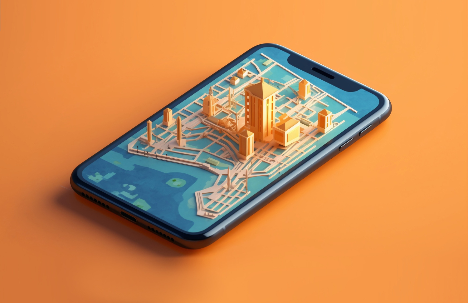
From the screen of your smartphone, picture yourself being able to investigate, evaluate, and even take part in the planning and administration of an entire city. At least some of this experience is currently available through the 3D photogrammetric tapestry of Google Street View, but city information modeling has the power to significantly enhance it.
Ordinary people might then use the open-source 3D model for a range of purposes, including as improved access to public services and as a repository of suggested improvements to the urban environment after virtual cityscapes created within CIM are made available to them.
Early on in the city planning process, citizens might use city information modeling to participate in the design process by offering suggestions to architects and engineers regarding the features and amenities they would most want to see. The rules and policies that are implemented inside a city’s boundaries may be impacted by the openness that city information modeling offers.
Toward the “Smart” City
These days, “smart cities” are the talk of the town. The Internet of Things (IoT) enabled metropolises to convert physical infrastructure into digital treasure troves of data and automated havens of comfort by utilizing a variety of sensors and other technologies.
Whether the concept can live up to all of its grandiose promises is another story, but if smart cities are to be developed, they must be firmly based on something that resembles CIM. In the future of smart cities, city information modeling provides an integrated digital foundation—a fixed command center, if you will—from which all data can be gathered and handled.
Reduced Public Inconvenience
Although the goal of urban planning projects is to enhance the quality of life for residents, due to their size, the building process itself may generate annoyance to the users. In urban infrastructure projects, limited access to demolished roads and land may result in gridlock, pollution, and other issues.
Urban designers and planners can now investigate the modular prefabricated building, which assembles built-environment components at the project site after they have been manufactured elsewhere, thanks to city information modeling technology. It shortens the time needed for building on site and contributes to the safety and quality of life of the nearby residents. Planners and citizens alike are finding that urban infrastructure developments are more enjoyable because of CIM.
Reduced Project Delays
The end-to-end planning and building process becomes highly simplified with CIM-driven cooperation, accuracy, early error detection, pre-fabrication, comprehensive visualization, and more. Each stakeholder is aware of the project elements that depend on them. Project timescales are shortened because urban infrastructures are planned and constructed with more visibility, transparency, and organization.

Improving Productivity, Efficiency and Results
Key project and asset knowledge is frequently lost in traditional building processes as one team transfers to another during different stages. City information modeling prevents this from happening by standardizing processes and benchmarks and centralizing all information to ensure that all resources are shared. In this manner, all pertinent data and errors are combined into a single platform, ensuring consistency and consolidation of expertise and facilitating the methodical resolution of issues by management and developers.
Because they can now precisely observe how the buildings in question are functioning and identify areas for efficiency, they can perform performance analysis more successfully and make more accurate assessments of the state of the involved assets. This leads to improved utilization and utilization of resources and assets.
In addition to saving time and money and maximizing outcomes, pooling resources and fostering more cooperation also enhances public services by better integrating them with real-time data and analysis—a crucial component of the smart city. Improved cooperation between various government departments and community stakeholders can also lead to more effective implementation of local programs and initiatives.
Empowering Citizens
Data is gathered via BIM or CIM and disseminated on a single platform for public access. Currently, not much BIM is open-source, but when it is, it gives the public access to information that is typically reserved for people directly involved in the planning and building process, enabling them to actively participate in the physical change of their city.
The development of mobile apps can also be aided by this openness. Take Toolz, a virtual reality map that provides models of metropolitan regions that the public can virtually modify to “test” out different approaches to urban design. The potential that city information modeling offers for community interaction has not yet been thoroughly investigated.
However, there are currently many opportunities for cities to connect various planning strategies with various citizen uses and needs thanks to the various project types that can be delivered through city information modeling. These projects provide and coordinate real-time data about the entire city as well as key infrastructure within it.
Minimizing Risk
There are a lot of dangers involved with constructing public infrastructure, such as roads, bridges, tunnels, and buildings. As a sort of “digital twin” or virtual “proof of concept” stage, building models of the surroundings that new projects will be placed in using BIM and CIM enables you to test the project both before and during the construction process.
This is especially crucial when it comes to risk because, with BIM, any possible mistakes or mishaps may be identified well before they become problems. The insurance sector currently uses city information modeling to evaluate how natural disasters, such as earthquakes, floods, or storm events, would affect specific buildings or areas; city governments and other businesses can also utilize it for this purpose.
Scenario modeling of this type makes it possible to analyze how specific events would affect current resources and how that would affect public safety.
Applications of CIM in Urban Design
The digital process known as city information modeling makes it possible to create, manage, and distribute intricate 3D models of infrastructure and structures. CIM can enhance cooperation and communication amongst parties involved in the design and development process, enabling urban designers to construct more cost-effective, efficient, and sustainable urban settings. There are several ways that CIM can be applied to urban design, including:
- Planning: CIM can be used to create detailed models of urban areas that can be used to simulate different scenarios and test the impact of new development projects on the surrounding environment.
- Collaboration: city information modeling can facilitate collaboration between different stakeholders involved in urban design, such as landscape architects, engineers, and contractors, by providing a shared platform for the exchange of information.
- Design: CIM can be used to create detailed designs of buildings and infrastructure within urban areas, allowing urban designers to explore different design options and analyze their potential impact.
- Visualization: city information modeling can be used to create visualizations and renderings of urban areas, which can help stakeholders better understand the proposed design and its impact on the surrounding environment.
- Maintenance and Operations: CIM models can be used to manage and maintain buildings and infrastructure within urban areas, allowing for more efficient operations and maintenance over the lifecycle of the development.
The Relationship Between BIM and CIM
Building Information Modeling and the upgraded city information modeling are currently developing a relationship because the construction sector is still, to some extent, adjusting to BIM. Though adoption has been sluggish in some areas, the majority of industry participants acknowledge that BIM will have a significantly bigger role in the future.
According to a recent Zion industry Research analysis, the BIM industry is likely to almost quadruple in size between 2016 and 2022, when it is projected to reach a valuation of $10.36 billion. Due in large part to a requirement that all projects sponsored by the central government be completed using collaborative 3D BIM, the UK is leading the globe in the adoption of BIM; however, other markets are gradually catching up.
Naturally, BIM makes use of 3D modeling, but it also incorporates data and information from every stage of a construction project’s lifecycle, going well beyond what traditional CAD can offer. The ability to cooperatively link various elements makes it possible to link many individual buildings together to create a larger project in the future.
By expanding this even further, you may connect individual BIM files to a larger platform that can be used at the municipal level. Beyond the scope of most BIM models and files, city information modeling includes links to public services, and infrastructure, and even simulates how people move through and engage with cities.
City Information Modeling and Sustainability in Smart Cities
Cities can benefit greatly from CIM’s assistance in achieving their sustainability objectives. BIM is a digital platform that integrates design, construction, and operating data to enable stakeholders to work together on a shared model of a building or infrastructure project. Cities can use this technology in several ways to maximize resource efficiency, cut waste, and meet their sustainability goals, such as:
Energy Efficiency
By enabling stakeholders to assess building energy performance and spot possibilities to increase energy efficiency, city information modeling technology can assist cities in meeting their energy efficiency targets. CIM models allow stakeholders to maximize energy use and cut costs by simulating HVAC systems, natural illumination, and thermal performance.
Waste Reduction
By maximizing the utilization of materials, city information modeling technology can aid in the reduction of waste in the building process. By combining prefabricated components and meticulous modeling of building systems to ensure precise installation, CIM models can find possibilities to reduce waste.
Water Conservation
Cities can accomplish their water conservation objectives by using city information modeling technology, which makes it possible for stakeholders to plan and operate water systems more effectively. Water flow simulations and water conservation opportunities, like installing low-flow plumbing fixtures or rainwater collecting systems, can be found with CIM models.
Sustainable Materials
By helping stakeholders recognize and use sustainable materials in their projects, city information modeling technology can assist cities in reaching their sustainability objectives. To help stakeholders choose construction materials wisely, CIM models can incorporate data on the environmental effects of various materials, such as embodied carbon.
Therefore, through maximizing resource efficiency, cutting waste, and facilitating well-informed decision-making, city information modeling technology can assist cities in realizing their sustainability objectives. Cities may encourage a more sustainable future and increase the sustainability of their infrastructure by implementing CIM into their planning and design processes.

How CIM can be Used to Design and Manage Critical Infrastructure Systems in Smart Cities?
Critical infrastructure systems in smart cities, like electricity and transportation networks, can be designed and managed with city information modeling. Cities can use CIM technology to represent infrastructure systems digitally, giving stakeholders better visualization, simulation, and management capabilities.
Transportation Networks
In smart cities, transportation networks can be designed and managed with city information modeling. Roads, bridges, and other transportation infrastructure elements are covered in detail in CIM models, enabling stakeholders to see the effects of suggested modifications and spot chances to improve performance. CIM models, for instance, can be used to optimize road network design and simulate traffic flow, which will lessen congestion and shorten trip times. To keep assets in excellent condition and reduce downtime, CIM models can also be used to manage the maintenance and repair of transportation infrastructure.
Energy Networks
Energy network design and management in smart cities can also be done with CIM. By including comprehensive data on power generation, distribution, and consumption in CIM models, stakeholders may maximize energy efficiency and cut expenses. CIM models, for instance, can be used to simulate energy consumption and spot areas where efficiency can be increased, like smart grids and energy storage systems. To keep assets in excellent condition and reduce downtime, CIM models can also be used to manage the maintenance and repair of energy infrastructure.
Water Networks
Water network design and management in smart cities can also be done with city information modeling. Water supply, distribution, and treatment system details can be included in CIM models, enabling stakeholders to optimize water use and cut expenses.
CIM models, for instance, can be used to predict water demand and pinpoint areas where consumption might be cut, like by installing rainwater harvesting systems and low-flow plumbing fittings. To keep assets in excellent condition and reduce downtime, CIM models can also be used to manage the maintenance and repair of water infrastructure.
In conclusion, vital infrastructure systems in smart cities, like electricity, water, and transportation networks, can be designed and managed using CIM technology. Cities can generate digital models of their infrastructure systems with BIM, which enables stakeholders to more efficiently visualize, simulate, and manage these systems.
Challenges of Implementing CIM in Smart Cities
Although there are many benefits to employing city information modeling in smart cities, there are several difficulties in doing so. The following are a few possible roadblocks to CIM technology integration in smart city projects:
Lack of Data Standardization
Integrating data from many systems and sources can be challenging in the absence of standard data formats and protocols. This may lead to problems with the quality of the data and complicate the management and upkeep of intricate infrastructure systems.
Interoperability
When disparate software applications and systems don’t communicate with each other well, interoperability problems might occur. This can lead to errors, inconsistencies, and data loss, which makes it challenging to produce BIM models that are accurate and trustworthy.
Cost
For certain stakeholders, using city information modeling technology may necessitate a large investment in hardware, software, and training. The overall cost of using BIM in smart city projects may also increase due to continuous maintenance and improvements.
Resistance to Change
Stakeholders accustomed to using conventional methods may object to the introduction of new technologies and workflows. Because of this, implementing BIM technology completely and utilizing all of its potential in smart city projects may prove difficult.
Data Privacy and Security
Sensitive data is gathered, stored, and shared when using BIM technology, which can lead to worries regarding data security and privacy. This can be particularly difficult in smart city initiatives involving numerous parties and substantial data sets.

Top 5 City Information Modeling Software
By enabling the creation, visualization, and manipulation of 3D models of buildings and landscapes, these software tools help designers get a better idea of how their creations will seem and perform in the actual world.
1. SketchUp
Urban designers use SketchUp, a widely known software application, for 3D modeling. This program is well known for having an easy-to-use interface. It is a vital tool for specialists in urban design since it provides a variety of tools for modeling streets, buildings, and landscapes in three dimensions.
SketchUp is a remarkable tool for designers because of its extensive 3D Warehouse, which provides a plethora of resources and ideas. There is a vast library of user-made models in The Warehouse that you can easily access and include in your projects. Because of this, SketchUp is a very effective tool for swiftly and effectively producing complicated designs.
2. Autodesk 3ds Max
Autodesk 3ds Max is an extensive software application used for 3D modeling and rendering. Thanks to its wide selection of potent tools and plugins, it is very common in the architecture and design sectors. This software’s capacity to generate excellent 3D models makes it a preferred option for modeling complex urban planning.
VRay compatibility is one of the 3ds Max’s most noteworthy features. It works with a variety of rendering engines. Because of this compatibility, designers and architects can produce incredibly lifelike renderings of their ideas, giving them a more tangible presence.
The rendering features of the program are also very helpful for producing virtual tours and presentations that provide clients with a more immersive view of their projects. Overall, Autodesk 3ds Max is a top-tier software application that enables designers and architects to bring their creative visions to life in a stunningly realistic and immersive way.
3. Rhino
Urban designers frequently utilize Rhino, a very flexible 3D modeling program, because of its remarkable capacity to manage intricate geometries with ease. Designers especially use this software since it can accurately create complex, eye-catching designs with remarkable detail.
The versatility of plugins like Grasshopper, which gives users strong modeling capabilities for producing intricate designs, is one of Rhino’s strongest points. Because of this, it’s the perfect software for designers who need a lot of freedom and control over their creative process.
The fact that Rhino supports several rendering engines, including VRay and KeyShot, is another noteworthy feature. Because of this compatibility, designers can produce excellent representations of their designs and effectively convey their concepts to clients or other team members. The rendering features of the software are especially helpful for producing realistic and captivating virtual tours and presentations.
4. Blender
An amazing array of features and tools are available in Blender, a free and open-source 3D modeling program, to help you create intricate designs. While some other software programs may be more widely utilized in the architectural and design sector, Blender has grown a sizable fan base among designers who prioritize customization and flexibility in their work processes.
Blender’s open-source nature, which permits anyone to download and use the program for free, is one of its main benefits. Because of this, independent designers and small enterprises who do not have the funds to purchase pricey software licenses frequently choose it.
Blender boasts an equally outstanding feature set, with a variety of tools and plugins that let designers construct complex designs with amazing accuracy and precision. The program is well-known for supporting 3D sculpting, animation, and visual effects, which makes it a great option for anyone trying to produce dynamic and eye-catching designs.
Furthermore, Blender’s high degree of customization lets users mold the program to suit their unique requirements and tastes. Because of its adaptability, designers who appreciate having autonomy over their workflow and the freedom to try out various methods and strategies have found great success with it.
5. Lumion
Lumion is a powerful real-time 3D rendering software that has gained popularity among urban designers for its ability to create immersive and interactive visualizations of their designs. Designers may quickly produce high-quality renderings by importing 3D models from a variety of sources using Lumion’s wide file format compatibility.
Lumion’s real-time rendering features, which let designers alter their designs and observe the effects instantly, are among its main advantages. Because they can instantly observe the effects of their changes and make necessary adjustments, designers can now iterate designs more quickly and efficiently.
A variety of built-in effects and tools are also available in Lumion to help create realistic lighting and materials, like water, vegetation, and weather effects. This makes it possible for designers to produce incredibly lifelike representations that faithfully capture their concept.
Moreover, Lumion is the perfect program for making virtual tours and presentations for clients because of its immersive and interactive capabilities. To give clients a more engaging and tangible experience with their designs, designers might produce realistic and detailed representations of their creations.

Future of City Information Modeling (CIM)
It will probably take a few more years for CIM to become as popular as BIM. The adoption of new technologies by the construction sector is generally characterized by a slow pace; yet, the advantages of city information modeling are too numerous to overlook.
Businesses that have spent the last ten or so years concentrating on BIM, such as Autodesk and Bentley, are gradually starting to allocate more of their efforts to CIM. The new normal will eventually include 3D simulations of cities like Virtual Singapore if all the stars align. The matter is made more urgent by the impending threat posed by climate change. The plain fact of the situation is that we must quickly rethink our cities.
City information modeling is quickly becoming a vital tool for future planning and construction as we strive to fit more into our urban surroundings. It will help us plan for all eventualities both inside and outside of those new buildings.
Few architects will ever forget the issues with the Walkie-Talkie building in London, whose curving glass walls focused sunlight and damaged surrounding buildings and parked automobiles. City information modeling tools would identify a problem like that extremely quickly, preventing the need for costly corrective action.
CIM is becoming more well-known. It is being used in several sectors. It’s the next big thing and anyone who don’t follow suit risk getting left behind in the worldwide building industry. The industry is moving away from traditional methods and toward city information modeling because of its capacity to provide better results at a reduced cost.
Conclusion
City Information Modeling generally involves building a 3D city model that connects with BIM and other contextual data sources or analysis tools of various city components, including buildings, roads and public spaces, streetlights (sensors/IoT), and even people on the street (social media).
For planning projects of any size involving individual buildings, campuses, and towns, city information modeling is unquestionably helpful for architects and planners. Users can access, analyze, and exchange data in real-time, anywhere in the globe, in dynamic, content-rich 3D city model settings that are made possible by linking BIM and CIM.
city information modeling is now our present rather than our future. However, there is still much to be determined about how it will develop and what part it will play in improving our quality of life while making our cities smarter and more sustainable. But one thing is for sure: CIM and digital technology will revolutionize the way we plan, construct, and run our cities.
Digital planning, design, collaboration, visualization, and maintenance are just a few of the urban development uses for city information modeling. In urban design, BIM software can improve teamwork, productivity, efficiency, visualization, cost savings, and sustainability. Through a variety of available courses, urban designers can advance their BIM software abilities and understanding.
In the end, city information modeling may assist teams working on urban design to produce more cost-effective, efficient, and sustainable urban settings while fostering better coordination and communication between the various parties engaged in the process of design and development.
FAQs
What is City Information Modeling (CIM) and how is it Different from Building Information Modeling (BIM)?
- Answer: Detailed 3D models of entire cities, including their infrastructure, buildings, and landscapes, can be created, managed, and shared using a digital technique called city information modeling (CIM). While BIM concentrates on the design and administration of individual buildings, CIM broadens its focus to include entire urban areas and employs a variety of datasets (GIS, LiDAR, and IoT) to simulate and manage systems throughout the city. Many people consider CIM to be the next step up from BIM, but on a city-wide scale.
What are the Main Components Used in City Information Modeling (CIM)?
- Answer: CIM incorporates a range of technologies and datasets, such as:
- Geographic Information Systems (GIS) are utilized for property data and spatial mapping.
- BIM, or building information modeling, is used to model particular structures in detail.
- Using LiDAR (Light Detection and Ranging), the physical features of the city can be precisely mapped in 3D.
- Real-time data collection from sensors across infrastructure systems, including public places, utilities, and highways, is made possible by the Internet of Things (IoT)
What are the Benefits of Using City Information Modeling (CIM)?
- Answer: Among the main advantages of CIM are:
- Centralized Information: To improve decision-making, information from several sources is combined onto a single platform.
- Enhanced Cooperation: By providing a shared, real-time model of the urban environment, CIM helps stakeholders work together more effectively.
- Data-Driven Planning: To improve walkability, infrastructure efficiency, and city sustainability, CIM enables the modeling of various design and planning scenarios.
- Decreased Project Delays: CIM reduces delays in urban development projects by providing increased transparency and early error discovery.
How does CIM Contribute to Smart City Development?
- Answer: By integrating IoT data and supporting the design and management of vital infrastructure such as energy grids, water systems, and transportation networks, CIM plays a major role in smart city initiatives. Smart cities can benefit from increased efficiency, decreased waste, and enhanced sustainability thanks to the provision of a real-time command center for monitoring, controlling, and optimizing urban services.
What Challenges are Associated with Implementing City Information Modeling (CIM) in Smart Cities?
- Answer: Several of the principal obstacles consist of:
- Data Standardization: In the absence of standardized data formats, integrating heterogeneous datasets from multiple sources can be challenging.
- Interoperability: Data sharing between several software platforms may be difficult, which could result in discrepancies.
- High Costs: The infrastructure, training, and technology required to adopt CIM can be expensive.
- Opposition to Change: Those accustomed to conventional planning techniques can be reluctant to embrace CIM technology.
What Software is Commonly Used for City Information Modeling (CIM)?
- Answer: The following software programs are used to generate and maintain CIM models:
- SketchUp: Well-known for its intuitive user interface and powerful 3D modeling features.
- 3ds Max: Popular for intricate modeling and rendering is Autodesk 3ds Max.
- Rhino: Known for managing intricate designs and complicated geometries.
- Blender: A free and open-source 3D modeling substitute.
- Real-time 3D rendering and immersive visuals are accomplished with Lumion.
Suggested article for reading:
Construction Takeoff; Comprehensive Guide 2024
LCA and Carbon Footprint: 10 Effective Reduction Strategies
The Role of PIM in Sustainable Construction (2024)
IIoT Technology: Top 7 Sustainable Practices It Enables
Top 23 Famous Women Architects in World; 2024 Review
11 Top Construction Project in Iran
How to Improve Construction Productivity? Guide to 2024
Resources:
Plannerly | One Key Resources | Linkedin | Digitalschool | Novatr | Trimble | Autodesk | Beesmart | Allplan | Urbandesignlab | BIMdesigns | Geospatialworld | BIMconnect
For the pictures: Freepik